Remote sensing for monitoring Environment

Research Topics
satellite remote sensing
Nowadays, earth observation satellite can acquire high quality image. The spatial resolution is less than 1m. When stereo image is acquired, 3D measurement can be carried out. For accurate measurement, following research topics are important
1.Accurate Ground Control Points
2.Establishing Geometric Model of Satellite Image
3.Stereo Matching
4.3D Coordinate Calculation
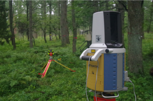
Laser scanner measurement
Field surveying is very important to validate results of satellite remote sensing. Laser scanner measurement has some advantages which are easy operating, easy transformation and real time measurement. However, laser scanner data has random noise. Therefore, noise elimination becomes research topic. For eliminating noise, following topics are important.
1.Accurate Ground Control Points
2.Accurate Geometric Correction
3.Surface Matching
Digital Photogrammetry
Nowadays, digital still camera has very high resolution CCD such as over 10 mega pixel. Therefore, digital camera becomes accurate measurement tools. For accurate measurement, following topics are important.
1.Orientation
2.Accurate Ground Control Points
3.Stereo Matching
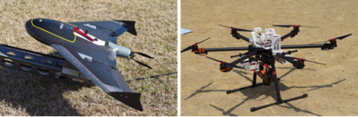
Platforms for Digital Photogrammetry
Satellite remote sensing becomes powerful method to monitor natural environments.
However, accurate measurement to detect change of natural environment is very difficult.
My laboratory has many issues of satellite remote sensing and the applications as follows;
-
-Remotely sensed data analysis
-
-Geographic information analysis
-
-Field measurements to validate the analysis
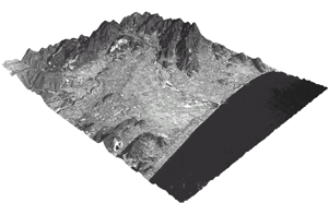
3D Measurement by Remote Sensing (ALOS PRISM)
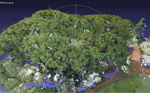
Laser Scanner Measurement
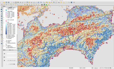
Geographic Information Analysis

高木方隆 Top